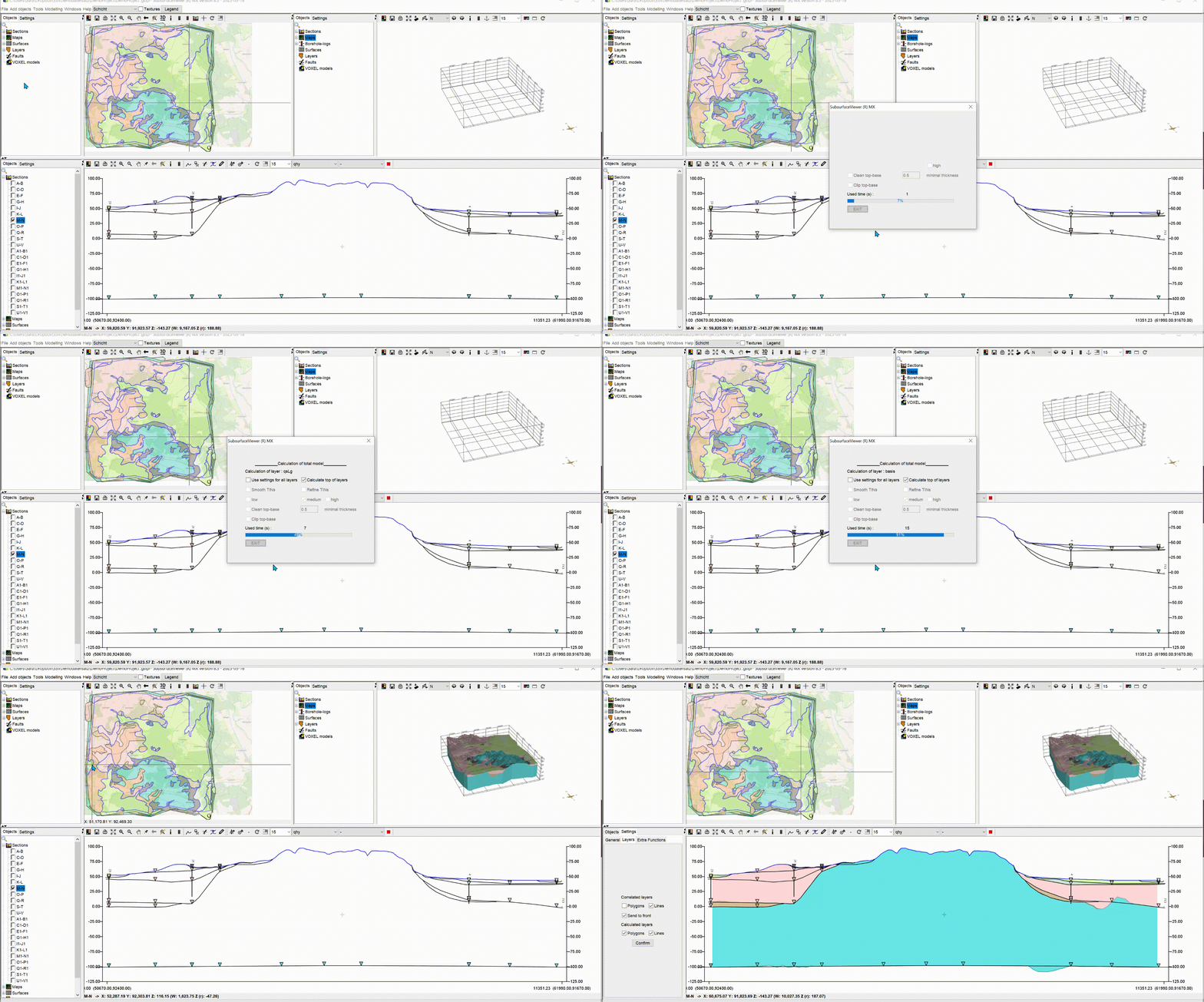
The lower edges of geological layer bodies are first calculated in the SubsurfaceViewer from young to old via the base nodes of all integrated lines (profile sections, structure maps), and, if necessary, additionally loaded XYZ point data sets, with a delaunay-triangulation. The heights at the nodes of the layer excavations are considered, which are drawn from the overlying lower edges or the DTM. Then, the upper layer edges are calculated from the common lower edges of the overlying layers (for layers close to the surface it can be the DTM).
After you have constructed the profile sections, defined the layer spreads and/or linked or constructed structural maps the model can be calculated.
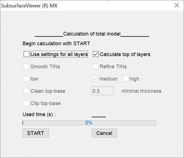
Under the menu item Modelling → Calculate all layers is the function with which all geological layers can be calculated at once. You can also calculate every layer seperately.
If you want or need to customise calculation settings for the layers, set the calculation settings for each layer and leave the check mark for use settings for all layers inactive. Otherwise the settings of the calculation will be overwritten by the settings made in this window. The details are explained in the respective sub-chapters.
Note: If you want to calculate the layers here in a regular way, over all layers and with point datasets, a DTM is always needed as TIN. How to convert a DTM-pattern into a TIN is explained here.
¶ Calculation settings for all layers


You can use some special functions for the calculation:
Smooth TINs and refine TINs with the corresponding settings low, medium and high are explained in the explanations of the triangulations. These settings are identical.
Clean top-base uses an indication of the minimum thickness of a layer within its layer spreading polygons. You enter this at minimal thickness. If an older layer bottom edge punctures a younger one, it is automatically pulled under the younger layer bottom edge with the minimum thickness. This is how you correct "unclean" constructions. Since it is not always possible in terms of time to create all edges and lines accurately in large, detailed conceptual models, you can help yourself further with this function. Our default setting leads to layer thicknesses of at least 0.5 metres within their constructed border.
With clip top-base is another solution for this. The same process takes place as with clean top-base, but with the resulting thickness 0. In the interpenetration areas, the layer bottom edge of the older layer thus receives the same heights as the layer bottom edge(s) of the overlaying layer(s).
With START the calculation is started.
Note: If you take a high-resolution DTM and/or have constructed densely populated nodes at the layer outcrops of the near-surface layers, the calculation of the young layers can take significantly longer than that of the older layers.
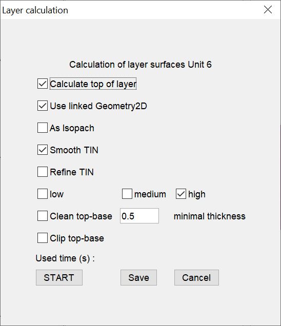
¶ Calculation settings for seperated layer

In the calculation options of individual layers you can link a structure map by means of use linked geometry2D via the functions described above. Read the linked articel for more information. The same applies to as isopach, with which you define whether your structure map is an isopach map.
You can save these settings for the time being with save without calculation, so they are considered in the overall calculation. When you start the calculation with START, the settings are automatically saved to layer.
¶ Further calculations on the layers
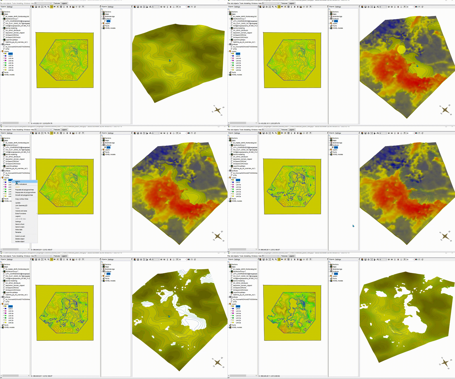
If you take a closer look at the context menu of the layer, you will find more entries to calculate the layer. The most interesting is the so-called virtual erosion.
¶ Calculate layer top
Here, the top is calculated individually for this layer. Use this function if you have imported a grid model based on the layer bottom edges and now want to calculate the layer top edges. You are no longer dependent on triangulations - not even in relation to the DTM.
¶ Clean top-base
This function is decribed here.
¶ Calculate virtual erosion
With virtual erosion, implausible penetration of the older lower edges with the overlying units or the DTM is solved by a calculated "erosion". All areas that puncture upwards are cut out. This function is advantageous for structure map modelling and is recommended to use - especially if you have constructed thin layers.
